
Treasure Coast · Florida
Indian River County Real Estate Investments
The Ligon Group evaluates Indian River County real estate investments across a Treasure Coast market where an established Urban Service Boundary separates most urban growth from large agricultural and conservation areas while the Indian River Lagoon, barrier island, wetlands and expanding utility infrastructure add another layer to residential property analysis.
Indian River County is not one uniform regulatory market. Vero Beach, Sebastian, Fellsmere, Indian River Shores and Orchid are incorporated municipalities, while substantial residential territory remains under unincorporated county land-use, zoning, building, utility and floodplain rules.
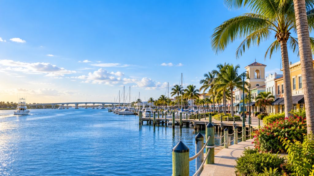
Growth Boundary · Lagoon · Conservation
Indian River County Real Estate Starts With Knowing Which Side of the Urban Growth Framework the Property Occupies.
Indian River County adopted its Urban Service Boundary in 1990 to define where urban facilities and services should support higher-intensity development.
Inside the Urban Service Area, the county directs suburban and urban development toward areas supported by roads, centralized utilities, stormwater management, public safety, schools, parks and other public facilities.
Outside that boundary, the development framework changes substantially. Agricultural, conservation and low-density property dominate much of the geography, and county policy intentionally limits conventional urban expansion.
The Ligon Group therefore evaluates Indian River County property by jurisdiction, Urban Service Boundary location, Future Land Use, zoning, utilities, environmental constraints, flood conditions and the physical residential asset itself.
Residential Market Structure
Four Indian River County Environments Create Different Investment Priorities.
Municipal housing, unincorporated urban property, rural land and lagoon/coastal property should not be underwritten through one generic county model.
Vero Beach + Sebastian Require Their Own City-Level Analysis.
Incorporated property can be subject to municipal zoning, planning, permitting and development standards that differ from unincorporated Indian River County.
County Housing Inside the Urban Service Area Operates Through an Urban Infrastructure Framework.
Established subdivisions, infill sites and residential corridors inside the service boundary can combine county zoning with centralized utilities, road access and existing public infrastructure.
Western and Environmentally Sensitive Land Uses a Much Lower-Intensity Model.
Large portions of unincorporated Indian River County outside the urban area are planned for agricultural or conservation uses rather than conventional suburban expansion.
Waterfront Property Adds Flood + Coastal + Environmental Due Diligence.
Property along the Indian River Lagoon or barrier island can introduce flood elevation, wetlands, shoreline, evacuation, utility and coastal-development considerations.
County or Municipality
The First Indian River County Question Is Which Government Regulates the Property.
County geography includes incorporated municipalities as well as a large unincorporated residential market.
Vero Beach, Sebastian, Fellsmere, Indian River Shores and Orchid lie within the broader county geography but maintain their own municipal boundaries and local development authority.
For unincorporated property, Indian River County's Future Land Use Map establishes the broad development pattern while the zoning map regulates permitted uses, housing types, setbacks, building form and development intensity more directly.
Acquisition analysis should therefore establish jurisdiction before applying any zoning, building or redevelopment assumption.
Asset + Growth Boundary + Water + Capital
Countywide Market Strength Does Not Replace Parcel-Level Underwriting.
Indian River County residential opportunities can sit inside very different development and infrastructure environments.
Existing homes can require roof, electrical, plumbing, HVAC, windows, structural, drainage, septic or interior modernization. Larger parcels can introduce wetlands, upland habitat, access or land-use constraints.
Lagoon and barrier-island property can add flood, elevation, shoreline and environmental issues. Existing septic systems may also intersect with ongoing county sewer-conversion programs.
The Ligon Group combines acquisition basis, physical condition, jurisdiction, service-boundary position, Future Land Use, zoning, utilities, environmental conditions, flood exposure and renovation scope before determining the investment strategy.
Urban Service Boundary · Growth Management
Indian River County Uses Its Urban Service Boundary as Both an Infrastructure Boundary and a Growth Boundary.
The county's Urban Service Boundary is one of the most important distinctions in unincorporated property analysis.
The boundary was adopted in 1990. County policy directs urban growth toward the service area, where infrastructure such as centralized water and sewer, improved roadways, stormwater management, public safety, schools and parks can support it.
Current county policy generally places residential development above very low rural density inside this urban framework. Property outside the boundary operates under substantially more restrictive density assumptions.
The county has also evaluated possible future changes to the boundary through a formal Urban Service Boundary Study. That planning work should be distinguished from the current adopted parcel rules in force at the time an investment decision is made.
Urban · Agricultural · Conservation
Crossing the Urban Service Boundary Changes the Development Assumption.
Indian River County's land-use strategy concentrates conventional growth while maintaining extensive agricultural and conservation geography outside the primary urban area.
Higher Density Is Tied to Urban Infrastructure.
Residential land inside the service area can support suburban and urban development patterns where public facilities and centralized infrastructure are available.
Outside the Boundary, Density Drops Sharply.
The county's Urban Service Boundary recommendations describe property outside the boundary as generally limited to a maximum residential density of one dwelling unit per five acres.
Active Agricultural Geography Remains a Major County Land Use.
Agricultural designations occupy large areas outside the urban growth framework, particularly in the county's western geography.
Some Land Is Intended to Remain Functionally Undeveloped.
Public conservation areas, wetlands and other sensitive lands can carry little or no practical residential development capacity despite their acreage.
2026 Utility Conversion · Indian River Lagoon
Septic-to-Sewer Conversion Is an Active Residential Infrastructure Issue in Indian River County.
The county is actively moving existing homes from individual septic systems to centralized sewer where service is available.
Indian River County's current program is intended to reduce nutrient loading to groundwater and the Indian River Lagoon while replacing older on-site wastewater systems with centralized utility connections.
As of September 2026, projects include Floravon Shores, North Sebastian, Wabasso Island and Hobart Landing, while a broader countywide sewer-conversion effort is moving forward across the North, Central and South utility-service regions.
For investors, that creates a practical due-diligence question: whether the property is currently on septic, whether sewer is available, whether connection is required or planned and what the resulting cost should be in the acquisition budget.
Indian River Lagoon · Barrier Island
Water Defines Both Property Value and Property Risk in Eastern Indian River County.
The lagoon, Atlantic coastline, barrier island and St. Sebastian River create residential environments where conventional zoning is only one part of due diligence.
Waterfront Property Interacts With a Protected Estuarine System.
Lagoon-adjacent sites can involve wetlands, shoreline conditions, dock or access issues, flood exposure and utility concerns that require parcel-specific review.
Coastal Housing Carries a Higher-Risk Storm Environment.
County planning identifies the barrier island as a high-risk hurricane area, adding evacuation, storm surge, wind, elevation and coastal-construction considerations.
Risk Geography Extends Beyond the Atlantic Beachfront.
The county's Coastal High Hazard Area includes the barrier island and additional land along the western side of the Indian River Lagoon, making exact parcel location important.
Water Access Should Be Underwritten With Long-Term Site Resilience.
Elevation, drainage, wetland boundaries, shoreline condition and existing structures should be evaluated together before a waterfront acquisition or major renovation is priced.
Wetlands · Habitat · Conservation Lands
Indian River County Treats Environmental Land as Infrastructure—not Leftover Acreage.
Conservation policy protects wetlands, habitat, water resources, open space and flood-storage functions while affecting how selected private property can realistically be developed.
Lagoon Wetlands Can Carry Extremely Low Residential Density.
County conservation designations along the Indian River Lagoon and lower St. Sebastian River can restrict residential density and require site-specific wetland delineation.
The County Is Still Actively Purchasing Environmentally Significant Land.
Indian River County's voter-authorized environmental lands program is acquiring property for habitat, water-resource, lagoon, flood and open-space protection.
Scrub + Hammock + Wetland Systems Can Affect Site Design.
Sensitive upland and wetland communities can introduce preservation, clearing, mitigation or development-layout issues on larger residential parcels.
Gross Acreage Is Not the Same as Buildable Acreage.
Environmental constraints should be incorporated before assigning residential development value to undeveloped or partially improved property.
FEMA Maps · Elevation · CRS Class 5
Indian River County Flood Due Diligence Goes Beyond Looking Up a Zone Letter.
Current FEMA Flood Insurance Rate Maps became effective in Indian River County in January 2023 and are used in county permitting review.
Indian River County participates in FEMA's National Flood Insurance Program and Community Rating System and currently holds a Class 5 certification for unincorporated areas.
The county also maintains elevation-certificate records for many previously developed properties and regulates construction in Special Flood Hazard Areas through its stormwater and flood protection code.
For investment analysis, the useful sequence is to combine current FEMA designation with Base Flood Elevation, building elevation, lot drainage, surrounding water systems and the proposed renovation scope.
Existing Housing · Utilities · Reinvestment
Infrastructure History Can Be as Important as Building Age.
Established Indian River County housing can combine older building systems with changing utility and neighborhood infrastructure.
Existing Homes Can Require Full-System Modernization.
Roof, HVAC, electrical, plumbing, windows, interiors and building-envelope condition should be understood before a renovation budget is established.
Wastewater Infrastructure Can Change During Ownership.
Existing septic systems should be reviewed together with current sewer availability and active conversion programs.
Lot Performance Is Not Explained by Building Condition Alone.
Grade, swales, culverts, impervious area and surrounding drainage can materially affect an otherwise serviceable home.
Existing Property Can Benefit From Coordinated Building + Site Improvement.
Residential repositioning can combine system upgrades, interiors, exterior improvements, utilities and site work rather than focusing on cosmetic renovation alone.
Acquisition Through Ownership
Growth and Conservation Policy Matter Only When They Connect Back to the Residential Asset.
The Ligon Group connects Indian River County jurisdiction, growth boundaries, utilities, environmental conditions and flood context with residential acquisition, renovation and real-property activity.
Begin With the Individual Property.
Condition, acquisition basis, lot configuration, ownership circumstances and existing improvements determine whether an opportunity supports deeper investment analysis.
Residential Acquisitions →Growth Boundary + Environmental Conditions Can Change Execution.
Jurisdiction, Future Land Use, zoning, utilities, wetlands, flood exposure and coastal conditions can materially affect the property strategy.
How We Evaluate Properties →Existing Housing Can Require Building + Infrastructure Work.
Renovation may involve major building systems, sewer or septic conditions, drainage, exterior improvements and site work in addition to interiors.
Renovation & Repositioning →Analysis Should Connect to Actual Real Estate Execution.
Portfolio and project activity connects market analysis with residential property The Ligon Group has acquired, improved, owned or operated.
Portfolio & Projects →Indian River County Real Estate FAQs
Direct Answers About Indian River County Real Estate Investments
Residential acquisition, growth-boundary, zoning, utilities, environmental and flood answers for Indian River County, Florida.
Does The Ligon Group invest in Indian River County real estate?
Yes. The Ligon Group evaluates residential acquisition opportunities throughout Indian River County as part of its Treasure Coast investment geography.
What is the Indian River County Urban Service Boundary?
It is the county's principal urban-growth boundary, identifying the area where urban development and supporting infrastructure such as centralized utilities and public services are primarily directed.
Is development outside the Urban Service Boundary more limited?
Yes. The county's current growth framework applies much lower residential density outside the boundary than in suburban and urban areas inside it.
Does Vero Beach use the same zoning as unincorporated Indian River County?
No. Vero Beach is an incorporated municipality with its own local planning and zoning authority. County regulations primarily govern unincorporated property.
Is Indian River County converting septic properties to sewer?
Yes. The county has multiple active conversion projects and in 2026 launched a broader countywide sewer-conversion effort where centralized service is available.
Do wetlands affect residential property in Indian River County?
They can. Wetlands, wetland buffers, conservation zoning and habitat conditions can change usable site area, development placement and residential strategy on selected parcels.
Should flood elevation be checked for Indian River County property?
Yes. The county uses current FEMA maps in permit review and provides flood-zone and elevation-certificate resources. Waterfront, barrier-island and Special Flood Hazard Area properties warrant additional analysis.
Can owners and real estate professionals submit Indian River County properties?
Yes. Owners, agents, brokers, attorneys, representatives, wholesalers and other professional sources can submit residential property opportunities to The Ligon Group for consideration.
Indian River County + Treasure Coast Markets
Move From the County Framework Into Its Major Residential Markets.
County-level growth, conservation and infrastructure policy sets the larger context while Vero Beach and Sebastian require their own local analysis.
Vero Beach
Vero Beach requires municipal analysis of established neighborhoods, historic context, barrier-island property, Downtown and city-specific zoning.
Vero Beach Real Estate →Sebastian
Sebastian combines established residential neighborhoods, municipal planning, St. Sebastian River geography and the Indian River Lagoon waterfront.
Sebastian Real Estate →St. Lucie County
St. Lucie County uses a different growth model centered on municipal expansion, county Future Land Use, rural-growth systems and regional infrastructure.
St. Lucie County Real Estate →Treasure Coast
Explore the broader investment geography connecting Martin, St. Lucie and Indian River counties.
Treasure Coast Real Estate →Indian River County Property Opportunities
Have a Residential Property in Indian River County?
Submit the property information currently available. The Ligon Group can evaluate the opportunity in the context of its physical condition, jurisdiction, Urban Service Boundary location, Future Land Use, zoning, utility status, environmental and wetland conditions, flood exposure, renovation requirements, transaction circumstances and potential investment strategy.